Under water
CR 13 remains closed from KC Road to CR 21
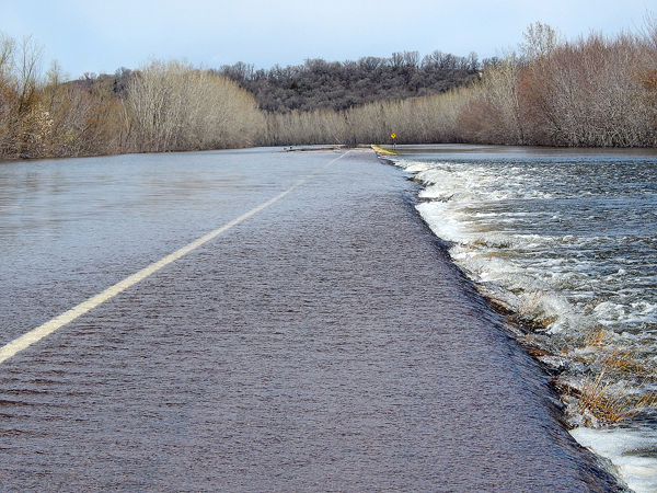
Staff photo by Fritz Busch The Minnesota River rushes over Brown CR 13 north of the city limits and south of the Beussman Bridge Monday. CR 13 remains closed from the KC Road to Nicollet CR 21 due to flooding. The river was observed at 804.18 feet at 11:45 a.m. Monday. Flood stage is 800 feet. The river is forecast to remain above flood stage through Monday, May 1.
NEW ULM — Corn stover (leaves, stalks and cobs) and small tree branches were seen on the closed portion of CR 13, south of the Minnesota River Monday, evidence the river is receding.
But the power of Mother Nature remained alive, creating a dull roar as water rushed over parts of the road, gouging out parts of the road shoulder.
After nearly reaching major flood stage Saturday, the Minnesota River at New Ulm began gradually receding Sunday, falling from 805.3 feet to 804.2 feet Monday. Flood stage is 800 feet. Historic crest is 811.03 feet on April 9, 1997. Recent crest is 807.56 feet on April 2, 2019.
The river is forecast to continue falling through minor flood stage this week, according to the National Weather Service (NWS) Advanced Hydrologic Prediction Service.
The Cottonwood River at New Ulm was observed at 9.16 feet Monday noon. It reached 11.51 feet Friday. Flood stage is 11 feet. Action level is 9.0 feet. The river is forecast to gradually recede this week.
Flood warnings continue for the Minnesota River at TH 19, Henderson; near Jordan, at Savage, U.S. Highway 212 at Granite Falls, at Montevideo and Morton; the South Fork Crow River at Delano and below Mayer; the Sauk River at St. Cloud, Crow River at Rockford, Mississippi River at Red Wing, St. Paul, near Hastings, at Highway 610 in Brooklyn Park; at Highway 169 in Champlin, at St. Cloud, at Fridley above 38th Avenue N.E. Other warnings include the St. Croix River at Stillwater and Rum River at St. Francis.
For more information, visit https://water.weather/gov/
Local News
Reflection on NUPS literacy plan
New Ulm - Amanda Thorson, the Director of Curriculum and Instruction, presented New Ulm Public Schools’ 2025-2026 ...

River Valley BMX back is back in action
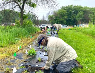
Pollinator Park planting day continues through the rain
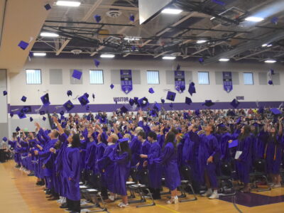
‘Don’t be afraid to go for it’
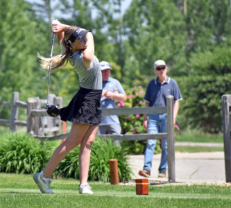
Tigers girls take home 2A golf title