Winter heat wave continues into next week
More precipitation forecast for late February
NEW ULM — It’s great weather for afternoon walks, but the local weather forecast looks bleak for snowmobile enthusiasts.
The Wednesday afternoon temperature in New Ulm reached 49 degrees, according to the National Weather Service (NWS). It was not an all-time record. That was set in 1977 at 59 degrees.
“The warm weather, much of it nearly 30 degrees above average, will continue into early next week,” said NWS Chanhassen Meteorologist Kaleb Grunzke.
He said New Ulm’s forecast highs are 51 for Thursday, 53 Friday, 58 Saturday, 56 Sunday and 59 degrees Monday.
If the forecast holds true, all-time records would be broken Friday and Saturday which have all-time high records of 47 degrees in 1967.
Grunzke said Wednesday high temperatures in southern Minnesota included 52 degrees in Marshall, Canby and Fairmont and 51 in Granite Falls.
He said the warmer than average temperatures are caused by the jet stream pushing warmer air from the desert southwest to the northern U.S. from now to the middle of next week.
“We’ll have a minor cool down next week with highs of 29 or 30 degrees, which are more like the normal highs of the upper 20s to low 30s,” said Grunzke.
He said Twin Cities snowfall is slightly below normal now at 29.6 inches so far while normal snowfall as of Feb. 11 is 33.5 inches.
More snow or rain is predicted.
“We’re forecast to have above normal precipitation for the end of next week and final week of February. It may be snow or rain. It’s too soon to tell now,” Grunzke said.
The U.S. Drought Monitor shows abnormally dry conditions in Minnesota southwest of the Minnesota River Valley.
Local News
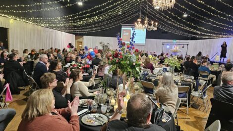
New Ulm Area Chamber of Commerce annual meeting
Sleepy Eye City manager announces retirement
NU EDA reviews Commercial Property Rehab loan program
NEW ULM – The New Ulm Economic Development Authority (EDA) held the first in a series of work sessions to review ...
Winter heat wave continues into next week
NEW ULM — It’s great weather for afternoon walks, but the local weather forecast looks bleak for snowmobile ...
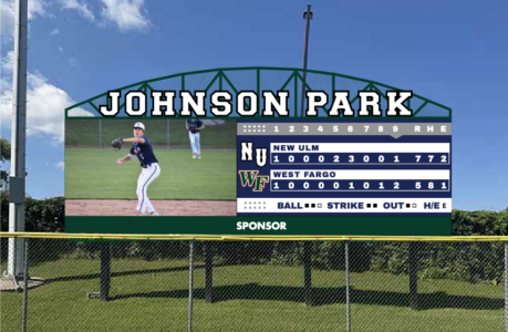
Commission recommends new video scoreboard for Johnson Park