Emphasizing flood preparedness
City has gates, pumps, berm to prevent floods

Staff photo by Fritz Busch City of New Ulm Emergency Management Director Dave Borchert stands on the flood berm near the Minnesota River on the south end of New Ulm. Borchert said he visits the area and Cottonwood River bridge area daily.

Staff photo by Fritz Busch
Two City of New Ulm water pumps are located at the lowest elevation point in town, along the flood berm east of Valley and 18th Street South.
The Minnesota River at New Ulm was measured at 800.46 feet at 8:45 a.m. Friday, about a foot lower than it was several days ago. The river is expected to fall below flood stage — 800 feet, Saturday night and continue falling to 797.5 feet Friday, July 18.
The 18th South Street flood gate closes when the river gauge reads 800.75 feet. The C Street flood gate closes at 803 feet. A flood gate south of 1301 Front Street South closes at 804 feet, the moderate flooding threshold. Other gate values close at 805.5 and 806.5 feet. Major flood level is 806 feet.
No homes are impacted until the river level reaches 810 feet.
The historic Minnesota River crest in New Ulm is 811.03 feet on April 9, 1997. The river reached 809.44 on April 15, 1969; 808.30 on April 16, 2001, and 807.7 on April 26, 2001.
Like he does every day, New Ulm Emergency Management Director and Police Chief Dave Borchert was at the 18th South Street flood gate with two pumps on trailers near a large drain between a berm and Valley Street.
“This is river water,” Borchert said looking at the large drain next to the two pumps. “You can tell it’s not backing up at this point. We leave the drain open. If it rains a lot, the area around the drain will fill up like a swimming pool. We can close a valve to turn off Minnesota River backup water here. The problem is this is the lowest point in town. When we get heavy rain, we end up getting lots of rainwater here that backs into the ally and yards nearby. If it rains faster than we can drain it, we’ll have to pump rainwater (over the berm, into the river).”
The $1.9 million berm along the Minnesota River protects 44 homes along nearly a mile of river on the south side of New Ulm.
“If we ever have to put sandbags on top of the berm, we can add 3 or 4 feet on top of it. The berm protects us to 814 feet here. It has saved us from flooding several times since we built it,” he said.
Borchert said FEMA (the Federal Emergency Management Agency approved the berm for federal funding but they recommended more costly home buyouts because they felt that was a better use of funds, he said.
“I’m at the Minnesota and Cottonwood Rivers daily,” said Borchert. “The Cottonwood level is not near flood stage right now at 5.9 feet now (Thursday). But it’s much more reactive and vulnerable to localized flooding. It’s much harder to predict.”
At an emergency management seminar at the New Ulm Community Center last October, Borchert emphasized flood preparedness. He said the river level averages 792 feet. It would top the CSAH 37 (20th South Street) bridge at 809.6 feet.
Borchert said he’s witnessed five federally declared natural disasters in Brown County, all due to flooding, since 1999.
Local News

Toying with miniature trucks
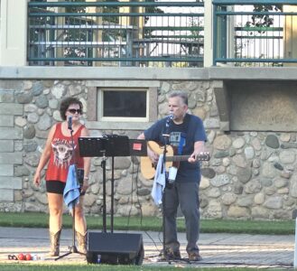
Chris & Chris concludes Concerts in the Park Season at German Park
Broskoff appointed to MN child protection council
NEW ULM — Brown County Human Services Director Anne Broskoff recently learned she was appointed to the Minnesota ...
Third Garden Terrace apartment building on New Ulm horizon

Nguyen family celebrates 50 years in America
Woman faces charges for allegedly shooting into neighbor’s house
WINTHROP — A 45-year-old Winthrop woman faces four felony charges after an Aug. 22 shooting spree in which she ...